Bay to Birdwood – Day 7 – Cobb Highway
Today was the penultimate day of our big road trip to Adelaide and back, and the biggest distance covered. We started early in Broken Hill, leaving at 0630 local time. Broken Hill observes South Australia time, so we lost half an hour heading east. We didn’t have a normal breakfast stop, the plan was to stop a rest area near Wilcannia rather than in the town itself.

The first around 180km were along the Barrier Highway, a route shared with our 2022 trip. The road out of Broken Hill was quite scenic and meandered through the foothills around the area. Since there was some cloud cover, there wasn’t too much glare in our eyes heading east early in the morning.
We stopped a Netallie Rest area for our breakast. I had purchased a bacon and egg role from a Broken Hill Service station. Two hours later the roll was better than I expected, but no culinary delight. As we waited at the rest area, a huge oversized road train arrived with a massive piece of hydraulic equipment on the back. The driver was checking the load was still secure, and it was a rather impressive piece of machinery. We assumed it was mining related and it had multiple 50T load points on it.

After the rest area, we continued into Wilcannia to use the strange service station from our 2022 trip. Since there is only one pump it took some time to fill 8 cars. I continued my trend of getting around 14.5l/100km in the 450SE. I had originally planned to have us refuel at Ivanhoe, but the petrol was 50c per liter dearer.

When the cars were refuelled, we crossed the bridge of the Darling river and exited town. We had been following the Darling river most of yesterday from where it joins the Murray near Wentworth up through Pooncarie and Menindee. It was just past here we diverted from the 2022 route, turning off onto the Cobb Highway. In 2022, the Cobb highway still had major sections unsealed. Now it is completely sealed from Wilcannia right through to Victoria.
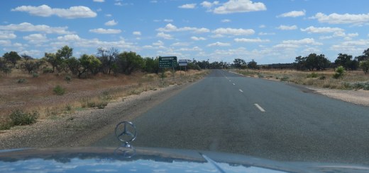
The highway runs in a South South East direction and is relatively straight. Since the section from Wilcannia to Ivanhoe was only sealed at the end of 2023, the surface is very good. Traffic was extremely light, so it was very relaxing driving along the road in the 450SE.

The first section is low scrubland, similar to what is seen around Broken Hill and Wilcannia. It looks like some of the area is used for low intensity cattle farming, with some sheep and goats. There were a decent number of trees, but nothing too big.
Driving along here, I think this is probably the most remote section of road I have been on. In the almost 400km we drove along it, there are only a few small settlements, Ivanhoe chief among them. We drove on some pretty remote roads last year heading to Longreach, but I don’t think any of them had such sparse population or traffic. Along the whole length of the road, we only had to overtake once, and there was probably only 10-15 vehicles going the other direction. These were mostly Landcruiser’s.
We stopped for a short break in Ivanhoe to stretch our legs. It was getting quite hot by now and there were flies everywhere. I was lucky to be sitting pretty cool in the 450SE when we were under way.

After leaving Ivanhoe, we continued south. There were almost no trees now, just low shrubs. The sky was blue and full of fluffy clouds. We had originally planned to stop at the pub in Booligal for Lunch. Booligal has less than 100 people and the pub is the main attraction. We crossed over the Lachlan river and entered the town, but sadly the pub was closed, so we had to continue to Hay. As we approached the Hay plain, the terrain became mostly low brown grassland with even more fluffy clouds.
We eventually got to hay after having covered almost 600km so far. At Hay we ate at a Bakery, I had a pie and a vanilla slice. We also stopped to take some photos at the historic railway station, which was our regroup point. Hay is situated at the Murrumbidgee river, which we crossed at Balranald, earlier in our trip.

Our final destination was Hillston, back on the Lachlan river. We drove there via Goolgowi, first on the mid Western Highway then the Kidman way. At Hillston we refuelled again, before checking into our hotel. We had covered 767km and 3666km since leaving Sydney. All our cars were able to handle driving this sort of distance in the head with no problem.
As is our tradition, we walked into the town for a succulent Chinese meal for the final night of our road trip. It had been a long but good day.